Understanding the Importance of Aerial Photography in Real Estate
Why Aerial Images Attract Buyers
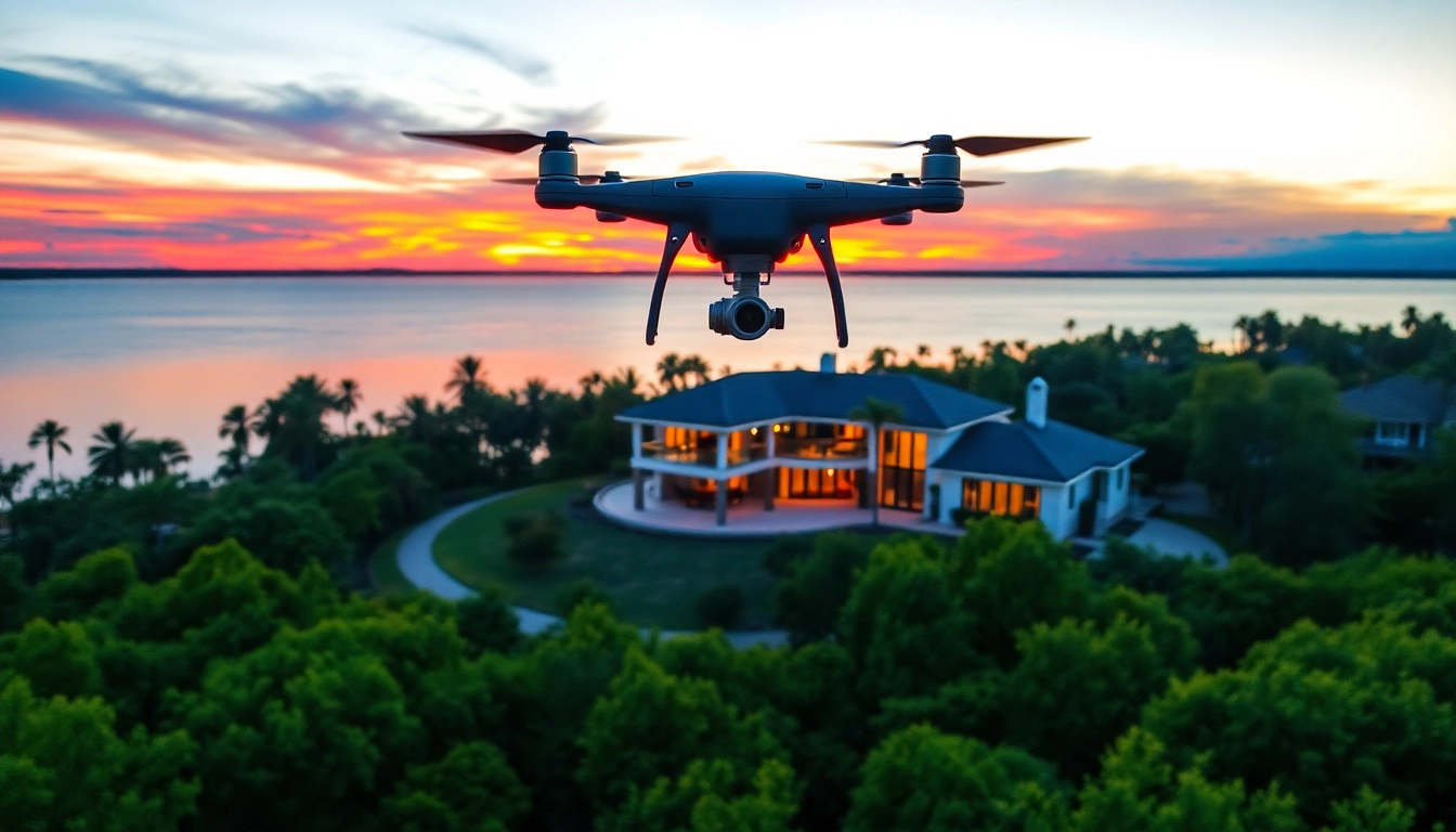
In the highly competitive real estate market, capturing buyers’ attention quickly is essential. Aerial photography can significantly enhance property listings by providing unique perspectives that traditional photography cannot achieve. With stunning aerial images, potential buyers can appreciate the full scope of a property, including its surroundings, scale, and features. This view not only showcases the property but also gives a sense of the neighborhood, nearby amenities, and the overall environment.
Beyond aesthetics, aerial photos help to highlight the property’s layout and land usage, making it easier for buyers to visualize potential uses and modifications. When customers see aerial views with vibrant colors and clear details, their engagement levels increase significantly, leading to more inquiry cases and potentially faster sales. Therefore, investing in a drone for capturing such images could change the game for many real estate professionals.
Key Features to Look for in a Drone
When selecting a drone for real estate photography, there are several crucial features to consider, including:
- Camera Quality: Look for drones equipped with high-resolution cameras (at least 12 MP) and the capability to shoot in 4K, providing sharp images and smooth video.
- Flight Time: Consider drones that offer longer battery life—ideally 20 to 30 minutes—so you can complete your filming without interruptions.
- Stabilization Technology: Drones with advanced stabilizers, like gimbals, ensure that the footage remains steady, even in windy conditions.
- GPS Capability: A drone with reliable GPS ensures precise positioning, which is useful for capturing high-quality, repetitive shots and flight paths.
- Range and Control: Opt for a drone that supports long-range controls and has a live video feed, allowing you to capture images and videos from higher altitudes and various angles.
Common Challenges to Avoid in Real Estate Photography
Even with the best drone, real estate photography comes with challenges. Awareness and preparation can help avoid common pitfalls:
- Bad Weather: Weather conditions like rain and high winds can adversely affect drone performance and image quality. Planning your photo sessions around weather forecasts is critical.
- Flight Restrictions: Ensure you are aware of local laws and regulations that could limit your flying area, as violating these can result in fines or legal action.
- Battery Management: Running out of battery mid-shoot can mean lost opportunities for critical shots. Always ensure your battery is fully charged before a session and consider carrying spares.
- Poor Composition: Compromised visuals can arise from lack of planning. Pre-visualize your shots and use guidelines to enhance the overall composition of your photographs.
Top Drones for Real Estate Photography: A Comprehensive Review
Best Drone for Real Estate Photography: Highlights
Choosing the right drone may depend on various aspects, including budget, experience level, and specific photographic needs. Here are some standout options for real estate photography:
- DJI Mavic 3: With its 20 MP Hasselblad camera and 4/3 CMOS sensor, it delivers unparalleled image quality and a robust flight time of up to 46 minutes, making it a favorite among real estate photographers.
- Autel Robotics EVO Lite+: This drone offers a 50 MP camera capable of 6K video, with impressive low-light performance and high-quality HDR capabilities, ideal for twilight shots.
- Skydio 2: Renowned for its autonomous flying capabilities and advanced obstacle avoidance, it’s perfect for dynamic and bustling environments, ensuring smooth filming without much manual effort.
- Parrot Anafi: Known for its compact size and lightweight frame, it includes a 4K HDR camera with a unique 180-degree gimbal for versatile angle capture.
Price Comparison and Value Assessment
When considering drone investments for real estate photography, price can vary significantly based on features and capabilities. Here’s a brief overview comparing different models:
| Drone Model | Price Range | Camera Quality | Flight Time |
|---|---|---|---|
| DJI Mavic 3 | $2,049 | 20 MP, 4/3 CMOS | 46 minutes |
| Autel Robotics EVO Lite+ | $1,499 | 50 MP, 1 inch CMOS | 40 minutes |
| Skydio 2 | $999 | 12 MP, 4K UHD | 23 minutes |
| Parrot Anafi | $699 | 21 MP, 4K HDR | 25 minutes |
Assessing the value of each drone means evaluating their features against your needs as a real estate photographer. While more expensive models offer advanced functionalities, they may not always be necessary for every photographer’s unique style and objectives.
User Reviews and Real-World Applications
User reviews can provide significant insights into the effectiveness of these drones in real-world scenarios. Many professional photographers emphasize the need for image quality and how aerial shots dramatically enhance listings. For example, one photographer noted that using the best drone for real estate photography boosted their listings’ engagement rates by over 60% compared to traditional images.
Additionally, testimonials often highlight user-friendly interfaces and sturdy construction, allowing photographers to focus more on creativity rather than technical difficulties. Exploring various platforms such as forums, YouTube reviews, and photography blogs often yields practical advice on each model, ranging from maintenance tips to innovative shooting techniques.
Techniques to Optimize Aerial Shots
Lighting Considerations for Aerial Photography
Lighting plays a critical role in photography, and aerial photography is no different. The time of day significantly impacts the ambiance and overall appeal of the images captured. Early morning and late afternoon are typically the best times for aerial photography as the light is softer and casts more dynamic shadows, enhancing features of the property.
When capturing shots during midday, which generally brings harsher light, consider using filters such as Polarizers to reduce glare and improve color saturation in your images. Additionally, controlling exposure is crucial; utilizing manual settings can prevent overexposed highlights, ensuring that intricate details remain visible.
Planning Your Flight Path and Angles
Planning the flight path is essential for both efficiency and creativity. Before flying, scout the property (if feasible) and outline potential angles that showcase its most appealing aspects. Use tools to create detailed flight plans or map out a series of waypoints. This planning not only guarantees comprehensive coverage but may prevent running out of battery on critical shots.
Moreover, varying your angles can significantly affect the final images. Try capturing at different elevations and distances; a higher altitude might be desirable for showing larger estates, while lower angles can capture detailed landscaping or architectural elements that draw buyers in.
Editing Tips for Stunning Real Estate Images
Even the best drone shots may require some editing to achieve a polished final look. When editing your aerial photos, consider these techniques:
- Color Correction: Ensure that the colors reflect the actual conditions of the property. Utilize tools like Lightroom or Photoshop for adjustments.
- Enhancement Filters: Subtle enhancements such as contrast adjustments can add depth and pop to your images without making them look artificially enhanced.
- Stitching Panoramas: For larger properties, stitching multiple photos can create a panoramic shot that provides a comprehensive view of the surroundings.
- Removing Distractions: Use content-aware fill or clone tools to remove transient objects or people that could detract from the property’s appeal.
Legal Aspects of Drone Usage in Real Estate
Understanding FAA Regulations
As drone usage has increased in various industries, so have the regulations governing their operation. The Federal Aviation Administration (FAA) has specific rules regarding commercial drone use, which include ensuring the drone is registered and the operator has a Part 107 certification. This certification requires passing a test regarding airspace regulations, weather knowledge, and operational procedures, ensuring that drone pilots operate safely and within legal boundaries.
Obtaining Necessary Permits
Depending on the location, additional permits may be required to film specific properties, especially in urban environments with heavy air traffic or near government buildings or airports. Investigating local drone regulations is critical before shooting as failure to comply can lead to fines and a shutdown of your business.
Respecting Privacy and Boundaries
Respecting privacy while capturing images is equally important. Drones equipped with advanced cameras can sometimes intrude on privacy, leading to potential legal issues. Make it a practice to notify neighbors before flying and avoid shooting in highly populated areas without explicit permission. Creating relationships with the surrounding community not only enhances your brand’s reputation but also promotes transparency in your operations.
Customer Success Stories: Drones Transforming Real Estate Marketing
Case Study: Sales Boost Through Aerial Imagery
Many real estate agents have reported significant improvements in sales performance after incorporating aerial imagery into their marketing strategies. For instance, an agent in San Francisco successfully sold a multimillion-dollar property within weeks of hiring a drone photographer, who showcased the stunning views of the Golden Gate Bridge that surrounded the estate.
In another case, a small-town agency noted a 40% increase in calls and offline visits after they included aerial perspectives in their property listings, proving that aerial photography can positively affect customer interest and drive sales.
Feedback from Real Estate Agents
Agents emphasize that investing in quality aerial shots often pays off, not only in terms of quicker sales but also in improving their professional image. Many have shared testimonials about how receiving high-quality photos for their listings led to an uptick in referrals and repeat clients. Some have even gone as far as recommending particular drone models based on their experiences, witnessing firsthand how technology can support marketing efforts.
Future Trends in Drone Technology and Real Estate
As drone technology continues to advance rapidly, several future trends could shape drone utilization in real estate. Enhanced AI capabilities may allow drones to map properties more precisely and create interactive 3D models that could be integrated into virtual tours. Additionally, innovations in battery performance are likely to extend operation times significantly, which means drone operators can survey larger properties more effectively.
Furthermore, as regulatory environments become more defined, we may see an increase in drone design specifically tailored for real estate applications. These could include user-friendly interfaces that simplify the shooting and editing processes, allowing even novice photographers to create professional-grade images easily. As these technologies evolve, the synergy between drones and real estate marketing will likely become inseparable, fundamentally changing the nature of real estate engagement.